DAY 29
I woke up and walked down to Chuck’s Little Diner for breakfast. Chuck was there, eating with some locals, discussing the finer points of living in a small town. Food prices, gas, and local gossip. One look at me in my dusty moto gear and they know I’m a traveler. They ask the usual questions about where I’m going and where I’ve been. I tell them I’m just out camping for a few days and the conversation drops off, back to local events. I like it better that way, no one making a fuss about me or my trip, just living under the radar. I just want to ride. For me.
I leave Prairie City for a quick ride through John Day to Mount Vernon. Here, I head south back into the forest. Riding through Mount Vernon I’m catching the last moments of morning before the day kicks off in full. Horses neighing, roosters crowing. I hear the faint chit-chit-chit-chit of an old sprinkler watering the grass. I can picture the spring loaded arm smacking the stream of water as it progresses across the yard and inevitably the sidewalk. I pass a pasture being watered by the big farm sprinklers and I smell cool damp air mixed with warm grass. On the south side of town the breeze is carrying cottonwood tree fluff across the road. I dodge them with my head, pretending I’m not allowed to touch them. Some sort of game I can imagine playing as a kid, but seems perfectly acceptable right now. Being on a motorcycle brings me so much closer to the environment around me, but I still have to make an effort not to blow by the details too quickly, they are easy to miss.
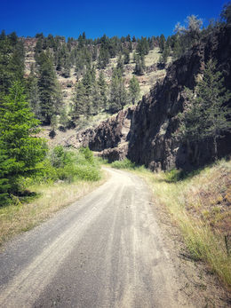
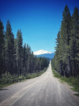
Once into the forest a good distance, I am fortunate to experience the best dirt of my TAT trip. A section maybe 5 miles long that had "hero dirt". Until now, Pennsylvania on the Mid Atlantic Backcountry Discovery Route had held my top spot for the nation’s best dirt roads. But this short section, nestled somewhere between John Day and Walton Lake was even better. It had traction that rivaled pavement, but looked like gravel and dirt. The harder I pushed and the deeper I let the bike rail into the corners the better it treated me. It was smooth without rocks or potholes. It was magic traction dirt and at one point I had to stop and feel it with my hand, trying to understand what made it so special. Anything better than this and it would surely require an entrance fee.
But one must take the good with the bad, and the motorcycle gods also bestowed upon me some of the worst roads right after that. It appeared that a tractor had recently tried to grade a section of the trail and failed miserably. The only thing I can see that was accomplished was laying down a layer of soft dirt a few inches deep and it looked as if the front edge of the bucket had clipped every rock in the road and uplifted them on top of this fresh surface. This was the first bad part.
The next bad road critique was the potholes. The absolute worst potholes. There were sections of road that looked like they had been graded using hand grenades. The potholes were the perfect size for a 21” tire to fit in. I don’t know how I didn’t get a flat or blow my shock seals out. I could avoid most of them, but the ones in the shade that snuck up on me were nightmares. The road felt like riding through a farmer’s field and I spent the next two miles up on the pegs.
I pulled into Prineville and stopped to eat. While eating I called around to shops to see if anyone had a new chain that would fit my bike. Pro Caliber Motorsports had what I needed and could do the work today if I hurried. I beat my GPS’s predicted arrival time by a noticeable margin. I provided the sprocket, they provided the chain, and I was the last bike out before the closing bell rang.
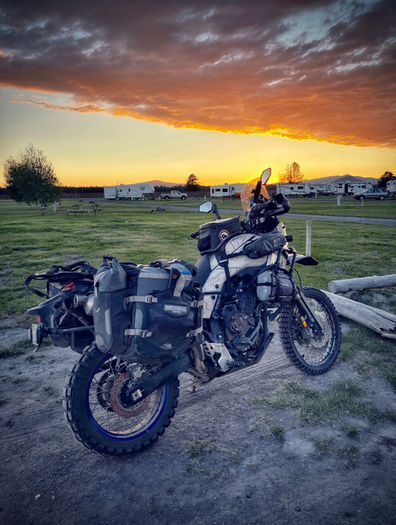
Upon leaving for my campsite I fell in love with my bike again. I have been needing a sprocket for a little while now. I turned down the road towards where I found a forest campground and passed an RV park. So I turned around and got a tent spot for $25 with hot showers and laundry, both checked off the list. I don’t really understand the appeal of RV parks. But for a hot shower and clean clothes I will complain about them another time. Hey, look at that sunset…
Good night

DAY 30
No alarm today. I wake up later than I’d like to but a part of me doesn’t really mind. Subconsciously, I know my TAT experience is coming to an end and maybe sleeping in is a way to delay the inevitable, if only for a couple hours.
At breakfast I go over my plan for the day. I know cell reception is non existent in many places in the forest going forward so I make sure to download all the map coverage I need. From previous experience I remember that the logging roads twist and wind all over the place. Reroutes can be necessary based on fallen trees or logging operations so having a detailed map on my GPS is a priority for me. Having plenty of fuel can turn into barely enough fuel pretty quickly if I have to make several reroutes. I’m not too worried though, my bike gets about 300 miles on these backroads. These are just things that go through my mind as I wait for my Denver omelette at the truck stop diner.
I had seen the report that Windigo Pass was open and the Aussies informed me that the road was clear after the pass so I had no reservations about the next part of the route. The flooded area just past the pass had almost dried up and was only damp. Perfect conditions really.
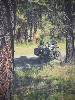
As I race along the now beautiful dirt two-track I’m making really good time in excellent riding conditions. I’m in a trance of sorts, not thinking, just in a flow with the road. Then I snap myself out of it. It’s easy to get in a rhythm that takes you out of the environment and focuses you on just the riding. At the next overlook, as soon as the trees part, I slow to a stop and put the kickstand down, turn off the bike, and remove my helmet. I wait for the last drops of hot oil to drip in the engine and then just listen to nature.
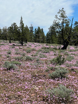
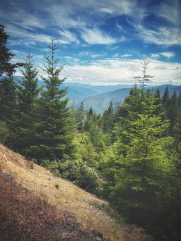
I don’t want my memories of this beautiful place to be two tire tracks and the wind rushing around my helmet. I remind myself to take a minute for the memory. The wind is gentle but steady coming up the slope and in through the pines on the ridge above me. The sky is clear and blue with dots of small white puffs. Bees are busily flying from here to there, pollinating the wildflowers growing just off the trail. The ants are marching along a log while birds sit high atop the darkened remains of the old growth trees that stand as a silent reminder of the power of fire. I try and burn it all into my memory and then I continue on.
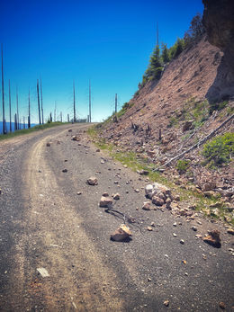
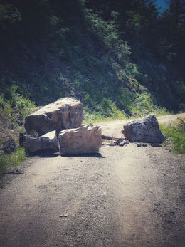
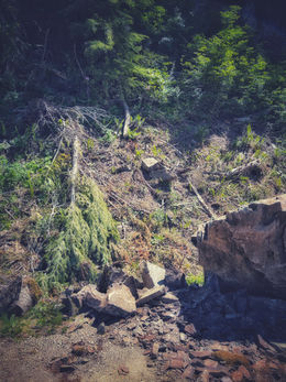
As I round a corner on Black Butte Road I am stopped by a rockfall. I notice there are no tire tracks anywhere so this appears to be recent. I give it a moment and listen for further activity from the rock face above me before having a closer look. The moss, grass and soil the rocks brought down with them are still damp, I must have literally just missed being an eye witness. I look up at the hillside and for a hundred yards in front or behind me this could happen again at any moment. The evidence of past shattered trees agrees with the theory. I clear a path between the rocks and mark the location on my map.
In Tiller, I go to the Pit Stop, which is I think one of the only occupied structures in town. I ordered a burger and fries from the nice young lady behind the counter. They had a small grocery section and plenty of drinks and water. This would make a decent place to get provisions for camp if I wasn’t already eating dinner here.
Later on I have to divert due to logging operations. Everyone is gone for the day so I explore past the detour sign and find the big excavators are parked in the road, thus ending any thoughts I have of squeezing by. The reroute is simple, maybe two or three miles at most. It actually turns into a great section and much better than where they are logging.
I find camp at Devil’s Flat, and this will put me in perfect position to make a stop for gas and breakfast before knocking out the final push to the ocean tomorrow.
Good night.

DAY 31
I wake up this morning with a lot of different thoughts in my head as I know others have had on their last day of the TAT. Bittersweet is the exact word for it. On one hand you can be proud of the accomplishment of riding across the USA on dirt roads and back roads, highways and byways. On the other hand, ending such a journey after a month of chasing that line on the map leaves something to be desired. I take a deep breath but I’m too far, I can’t smell the ocean yet.
As you know by now I have many waypoints along Sam’s TAT route that I saved from doing it in 2018 in my truck. Two such memorable waypoints are labeled “manzanita start” and “manzanita end”. Between these two points are what I believe to be my personal greatest challenge of the TAT. It is comprised of several steep sections of road with direction changes and a very long uphill section of baby heads. The section climbs 1,000 vertical feet from 3,600ft to 4,600ft in a distance of 1.3 miles. Welcome to what I have named "Manzanita Hill".
Like any situation that doesn’t go as planned, I went into this one full of gumption and confidence. By the time I fully understood the condition of the hill climb I was committed to, it was far too late to stop or back down and I was in it to win it. Like many of the difficult sections I drove in my truck, I don’t remember this one being a standout. That’s because I sit in my comfy chair and let it walk up in 4Lo. But it is definitely standing out to me right now. I know I need to keep speed and momentum up but the rocks have other intentions. I make a valiant effort and make it quite a ways but it only takes one misplaced tire to ricochet off one rock to start the chain reaction of missteps to degrade my momentum until the steepness of the grade, the weight of the bike, and the available traction culminate in that final moment where you realize you must come off the pegs and put a foot down because you aren’t going any further.
There are only two places a guy like me with shorter legs can put his foot down. A place where I can reach the ground and a place where I can’t. This is the latter and with nothing but air between the ground and my toes the bike slowly decides to take a nap. I step off casually and let the bike's weight be taken up on the right pannier bag. Then assess the situation and my options.
First off, I’m going uphill on baby heads and bigger rocks, I know at my bikes fully loaded capacity I can’t get started on this surface. Even empty, I’m just in a bad spot and I need to relocate the bike. I remove the left pannier and the top duffel and stand the bike up on the kickstand, then remove the remaining pannier.
At this point I have at least a 400ft climb to get in a position I can ride off from and try the rest of the climb on the bike. I take up position on the left side of the bike and walk it up the hill carefully using the clutch and throttle to match the speed I can climb the hill walking with the bike. Careful not to slip the clutch too much, knowing it is essential equipment. I can only go about 100ft at a time before I need to catch my breath, the bike is still heavy and I support some of it leaning against me so I can ensure it doesn’t tip away from me. Eventually I make it to where I’m pretty confident I can ride up the remaining hill. I hope. I just know forward and up is my only option so I better get it done. This is solo riding.
I then walk to the bottom of the hill to retrieve my duffel. The duffel isn’t exactly lightweight goods. I can carry it about 40ft at a time uphill in the rocks before I need a short break and I need to do this about ten times up the hill. After that I go back for the panniers. Back down the hill, this time one pannier in each hand. At least I’m balanced, but twice the weight. It takes me a long time and many stops to reach the top. By the time all of my inventory is in one place again I’ve been hauling bike and luggage for over an hour up this damn mountain. But now that it’s here I’m determined to ride this big pig the rest of the way up no matter what. I reattach everything and scout up the hill a little. The road turns and keeps going up. I cuss to myself but I’m getting up this hill.
I get my gear on and start the bike. I don’t give enough time for my mind to start thinking of “what-if” scenarios, the clutch is out and I’m up on the pegs. Standing, moving, dodging rocks. Look ahead, find the line, accelerate. Just. Don’t. Stop.
I’m climbing higher and higher, and I know it has to end it just seems like I’m on a treadmill mountain. By the time I reach the top the trail is surrounded by trees and everything is shrouded in clouds. I pause and breathe in deeply. I smell pines, but I can’t smell the ocean yet. It’s been a good two hours getting to the top of this mountain and all because of one rock. That’s part of the magic of the TAT. We all have our own experiences based on light bikes and heavy bikes and varying trail conditions. We choose our ride and ride it. That part was mine.
I arrive at my breakfast spot now in time for lunch and have a meal I fully worked for. Then I top off with fuel and begin the run to the coast.
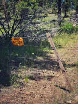
Just past Glendale the route turns north and heads back up for a short stint through logging areas in the mountains. This is the section where I broke my arm on my 2018 trip. As I am approaching a gate a forestry worker is closing it due to some logging operations so I did a short reroute and met up with the TAT on the back side. On the reroute I was able to see some retaining walls for the railroad line that are still in use made in 1890.
Later on, somewhere down the line the trail turns to pavement and a single lane unmarked ribbon of asphalt guides you along the way. It was somewhere along here, still way out in the forest, that I came across a man that flagged me down. Let me paint the picture. He had a bicycle, and attached to it was one of those child carrying chariot things. But there were three. The man was pulling triples like an Australian land train across the outback. He obviously had all his possessions in those things he was towing around. When I stopped, the man could have asked for anything. But he simply and honestly asked, “Do you have any food?”
I was taken aback for a moment and had to think. I hadn’t been carrying food since food joints are around everywhere along the TAT but I remembered I had stowed away some tuna sandwich kits and a bunch of trail mix. I gave the man every edible thing I could find on my bike. He thanked me, we exchanged names and we shook hands like men. His name was Willie.
I thought a lot about Willie in the miles that passed after that. I didn’t know his situation. I didn’t know why he was so far away from any sort of town. But I know that the food I was carrying was going to end up in the trash at the end of the trip, to me it was the least valuable of all my possessions, and to another man it was the most valuable. That affected me, and it put things into perspective.
As I ride away, I take another deep breath but I still can’t quite smell the ocean yet.
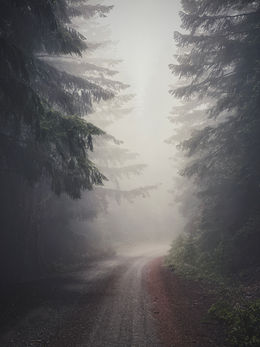
The trail eventually turns back to dirt and I begin the last section of gravel roads on the entire TAT. The route winds through mountains and every time I think I should be going down the road climbs back up. I know the trail ends at sea level but I’m still at 3,200ft. The coastal clouds drift along at the same altitude until they crash into the same trees I’m riding through. The eerie fog is a joy to ride through. The temperature fluctuates between 70° and almost 50° several times throughout the day. Soon I begin to see the altitude on my GPS decrease as I weave through the coastal forest to lower elevations.
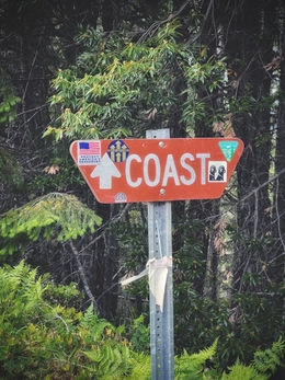
The trail effectively ends with the termination of Forest Road 5502 when it meets Elk River Road and the rest of the ride will be on pavement. A left turn on Hwy 101 and a short cruise into Port Orford. I take a deep breath and now I can smell it. That salty sea air I remember from 6,000 miles ago on the ferry crossing from Okracoke Island. Almost the entirety of the lower 48 between these two points. Coast to coast on dirt. Well, mostly.
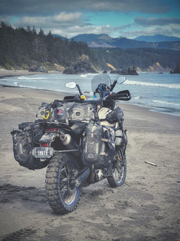
I have to get a photo on the beach so I ride down the short but steep beach entry road onto the sand. An astute bystander and fellow moto fan brings me a small piece of driftwood to put my kickstand on. Not even my oversized kickstand foot could support the Tenere in this sand. The driftwood does the trick. Soon two other TAT riders finish their journey on the same beach. Two more coast-to-coasters. We chat a bit and all go to dinner at the Crazy Norwegian for fish and chips. It’s kind of a TAT tradition. Its fitting to be ending the TAT and meeting new riders at the same time.
And with that I head south and find a quiet campsite within earshot of the crashing waves of the Pacific. I reflect on my day, my week, my month and the last 8 weeks I’ve been on the road with my bike crossing the US twice and seeing some of the most beautiful parts of our country. Over 11,000 miles and I still have about 1,300 to get home. No trailers, no flats, no breakdowns, not even one loose screw. It has been a perfect trip, just me and my Tenere and some new friends along the way.
One final time from the end of the Tran America Trail,
Good night.

